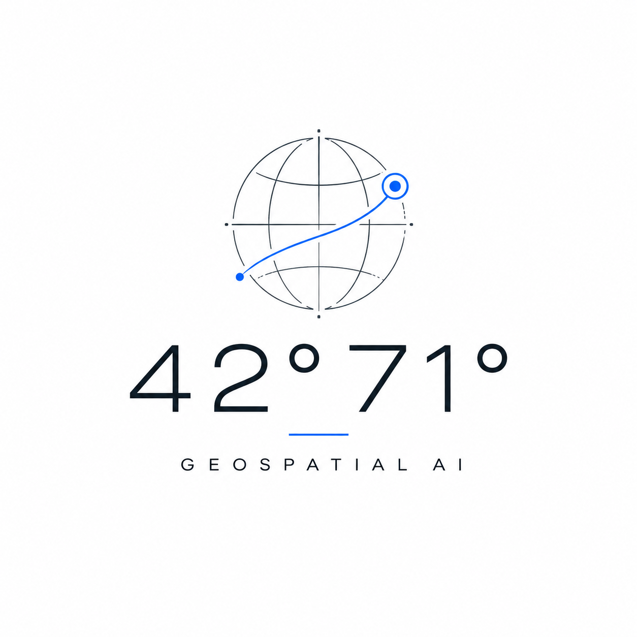
Geospatial AI Platform
Spatial Intelligence
Visualized
42°71° is a geospatial AI studio building high-performance mapping interfaces for route networks, terrain intelligence, indoor GIS, emergency response, and environmental operations.
Selected Work
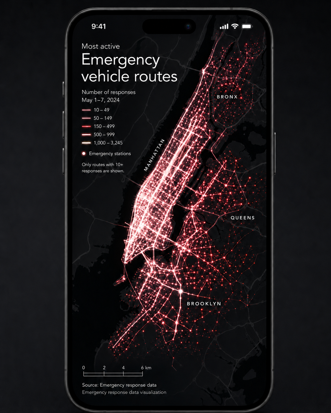
Response Corridors
Emergency Vehicle Route Intelligence

3D Dispatch
Emergency Response 3D Route View
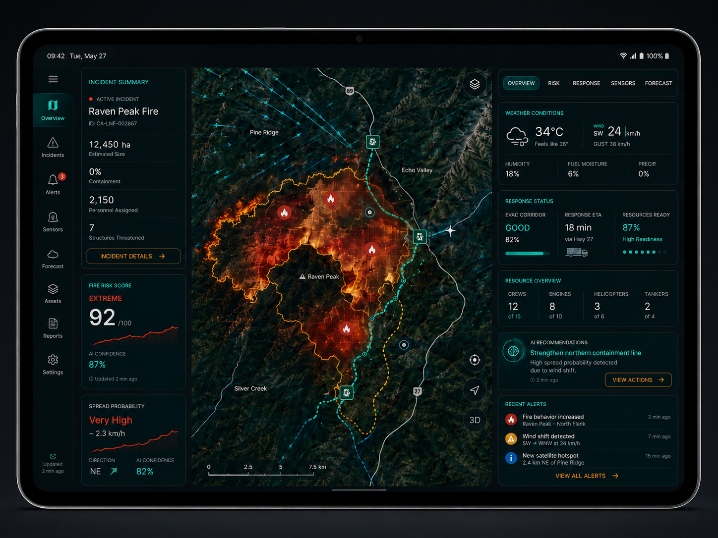
Field and Command Response
Wildfire Intelligence Phone and Tablet App

Ocean Intelligence
Marine Mapping Mission Control
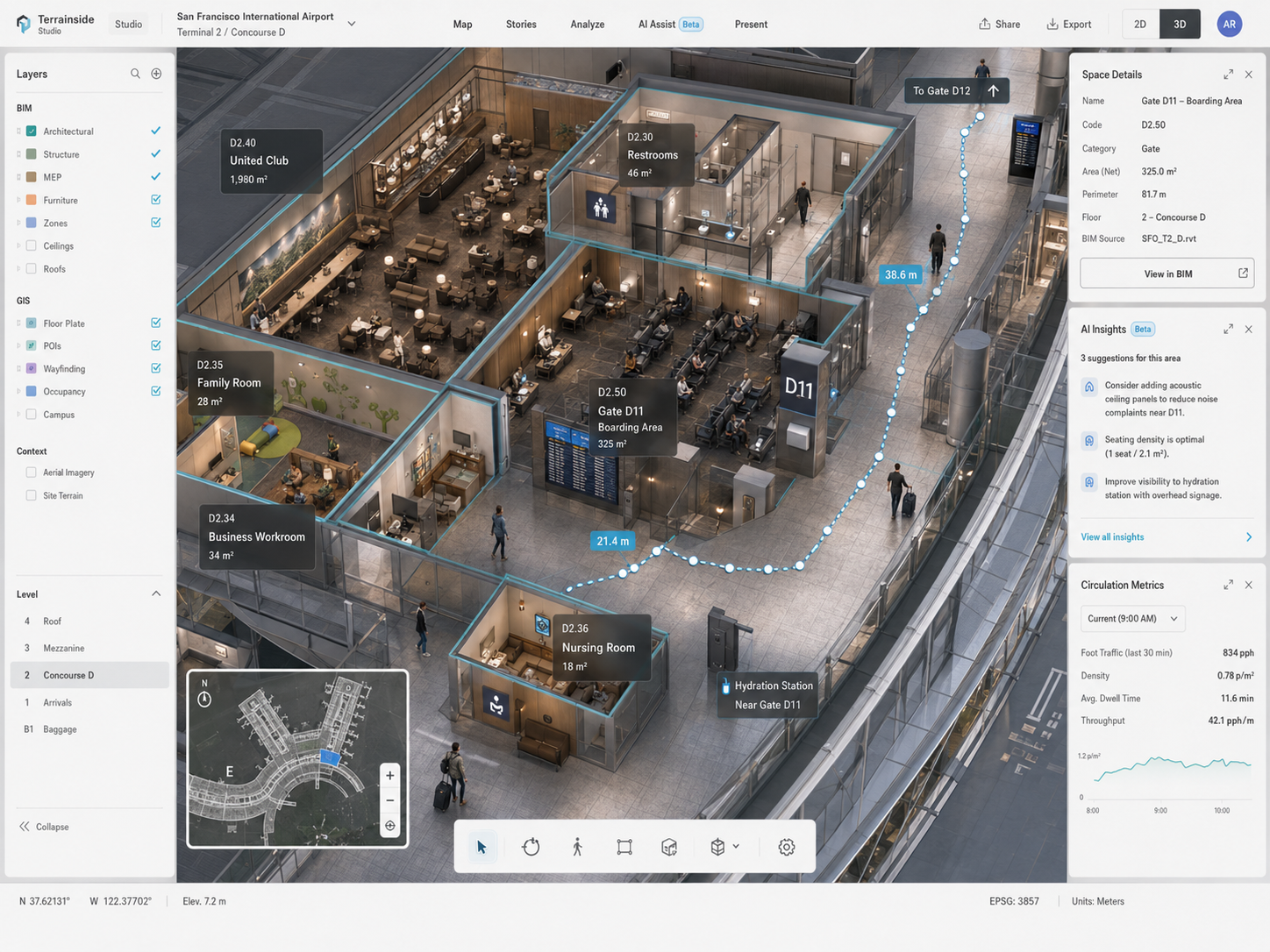
Desktop and Mobile Indoor GIS
Airport Indoor Mapping Platform
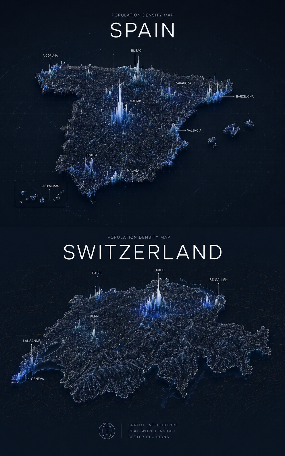
Cartographic Studies
Population Density Map Studies
Platform Capabilities
Route Networks
Density rendering, movement corridors, and response-time analysis
Terrain Intelligence
Contours, bathymetry, wildfire risk, and operational map layers
Indoor GIS
BIM-aware interiors, wayfinding, occupancy, and venue operations
3D Visualization
Urban geometry, building extrusion, and realistic spatial context
AI Interpretation
Pattern detection, confidence scoring, and operational recommendations
Multi-surface Design
Desktop, mobile, tablet, command center, and presentation workflows